
Batur is one of the still active volcanoes in Bali Island, Mount Batur consists of three volcanic cones with each crater, Batur I, Batur II and Batur III. Mount Batur has erupted many times. The eruption of M. Batur recorded in history began in 1804 and the last eruption occurred in 2000. From 1804 to 2005, Mount Batur has erupted 26 times and the most violent occurred on 2 August and ended on 21 September 1926.
Located in the northwest of Mount Agung, the breathtaking panorama of Mount Batur is surrounded by a caldera measuring approximately 13.8 x 10 km and is one of the largest and most beautiful in the world.
There are several things to consider before starting to climb Mount Batur Batur among them:
- Weather factor, weather in Kintamani area is very tropical. Rain can come at any time and also the movement of the wind that suddenly changes
- Health factors: not recommended to ride in a state of unhealthy
- Equipment, Mount Batur has a rocky and sandy landscape, sharp rocks formed from lava eruptions along the path of climbing. Make sure you use strong footwear, such as very thick mountain shoes so your feet do not hurt when stepping on the rocks. Wear trousers without jeans to keep the steps light and elastic. For the jacket should be used to avoid cold wind attacks.
Ascent usually begins around 04.00 am, before starting climbing Mount Batur, then you must register at Mount Batur Mountain Assembly Guide (HP2GB). In your post you will be warmly welcomed by the HP2GB team, and will explain what you need to do before making the climb. and for foreign tourists must use the guides provided by HP2GB team. It would be better if you climb Mount Batur in the group at a cheaper cost if you want to hire a guide. this guide will take you and your group up Mount Batur, they will always keep you and your group along the way while telling you about the mountain batur.
From HP2GB post, the trip will go to the grand temple of Batur mountain market (Pura Pasar Agung), Here we will walk towards the first post. In this post we will find an inscription explaining the condition of Mount Batur before the eruption, due to eruption, and the formation of Mount Batur as geopark. From this inscription we will pass 3 more pillars to reach the peak of Mount Batur. Post used as a resting place.
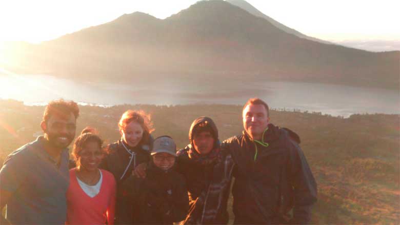
In the last post you will see the awaited moment, you will see the beauty of the sun rising over the top of Mount Batur. Here there is a mountain gap that releases hot steam. Many tourists take advantage of this phenomenon by boiling eggs. We do not have to bother bringing pots and water to boil eggs, simply by laying eggs in a small cave that releases hot steam and waits for about 15 minutes for the egg to mature.
SAFE TIPS TO CLIMATE TO THE MOUNT BATUR
One of the safe and important tips for climbing Mount Batur (Kintamani) is by using a guide or guide guide. Batur Mountain Tour Association (HP2GB) as a tour guide of Mount Batur, strongly recommends that every tourist who climbs the mountain using a guide. for the safety of climbers.
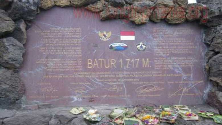
 Each guide usually invites 2 to 5 climbers. The climb of Mount Batur usually starts around 4 am and the time it takes to reach its peak is about 1.5 hours. The height of Mount Batur is 1717 meters.
Are you still curious about climbing Mount Batur?
Please join us soon, we provide a wide selection of packages for trekking to Mount Batur at low prices.
Thank you for reading our article might be useful …